
MATRIX Vi
-
MATRIX VI — GENERASI BARU GNSS VISUAL
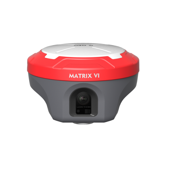
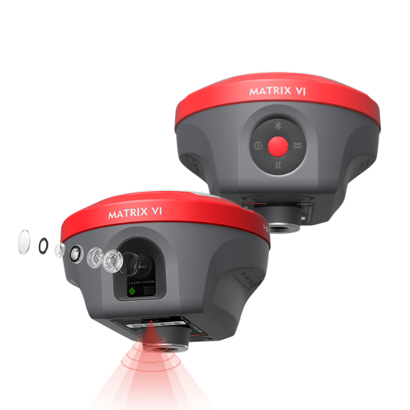
Matrix VI merupakan receiver GNSS multifungsi generasi terbaru yang mengintegrasikan teknologi Visual Positioning, AR Real-Scene Stakeout, dan Laser Measurement dalam satu perangkat.
Kombinasi teknologi tersebut menghadirkan terobosan baru dalam pekerjaan survei, melampaui keterbatasan GNSS konvensional serta memberikan kemudahan, fleksibilitas, dan produktivitas lebih tinggi bagi surveyor di lapangan.
Visual Positioning • AR Real-Scene Stakeout • Laser Measurement
Satu Receiver. Lebih Banyak Kemungkinan. Lebih Produktif di Lapangan.
MATRIX Vi
MATRIX VI — GENERASI BARU GNSS VISUAL
Matrix VI merupakan receiver GNSS multifungsi generasi terbaru yang mengintegrasikan teknologi Visual Positioning, AR Real-Scene Stakeout, dan Laser Measurement dalam satu perangkat.
Kombinasi teknologi tersebut menghadirkan terobosan baru dalam pekerjaan survei, melampaui keterbatasan GNSS konvensional serta memberikan kemudahan, fleksibilitas, dan produktivitas lebih tinggi bagi surveyor di lapangan.
Visual Positioning • AR Real-Scene Stakeout • Laser Measurement
Satu Receiver. Lebih Banyak Kemungkinan. Lebih Produktif di Lapangan.
Specifications
| GNSS Performance | Signals tracking | GPS: L1C/A,L2C,L2P,L5 |
| GLONASS: L1,L2 | ||
| BDS: B1,B1C,B2,B2a,B2b,B3 | ||
| GALILEO: E1,E5a,E5b,E6 | ||
| QZSS: L1,L2,L5,L6 | ||
| SBAS: WAAS,EGNOS,MSAS,GAGAN,SDCM | ||
| Channels | 1408 | |
| Cold start | <60s | |
| Hot start | <15s | |
| Positioning output rate | 1Hz~50Hz | |
| Signal reacquisition | <1s | |
| RTK initialization time | <5s | |
| Initialization reliability | >99.99% | |
| Time accuracy | 20ns | |
| Positioning accuracy* | Code differential GNSS positioning | H: 0.25m+1ppm RMS |
| V: 0.50m+1ppm RMS | ||
| SBAS differential positioning accuracy* | Typically< 5m 3DRMS | |
| Static surveying | H: 2.5mm+0.5ppm RMS | |
| V: 5mm+0.5ppm RMS | ||
| RTK surveying(baseline<30km) | H: 8mm+1ppmRMS | |
| V: 15mm+1ppm RMS | ||
| Network RTK* | H: 8mm+0.5ppmRMS | |
| V: 15mm+0.5ppm RMS | ||
| Laser measurement | ±1cm+5mm/m | |
| Sensor | IMU | Supported,4D lMU initialization in 3 seconds |
| Update rate | 400Hz | |
| Accuracy | <2.5cm within 120° | |
| Tilt compensation | 0~120° | |
| Camera | Visual camera | Global shutter with 2MP |
| AR camera | 5MP | |
| FOV | 84° | |
| Physical | Materials | Magnesium alloy |
| Dimensions | 129mmx129mmx99mm | |
| Weight | <0.8kg | |
| Operating temperature | -40℃~+75°C | |
| Storage temperature | -55℃~+85℃ | |
| Waterproof/Dustproof | IP67 standard, protected from 30min immersion to depth of 1m | |
| Shock | Survive a 2m pole drop onto concrete | |
| Vibration | MIL-STD-810G | |
| Humidity | 100% non-condensing | |
| Eletrical | Power supply | 9~24V DC external power inputto 5-pin LEMO port Supports Type-C fast charging |
| Battery | Built-in 7000mAh-7.4V Li-ion battery | |
| Battery life | Rover mode: 12hours | |
| Base mode: 7hours | ||
| Static mode: 15hours | ||
| Communications | l/O interface | 1*5-pin LEMO port, power supply, RS232, external radio communication port |
| 1*USB Type-C port, charging, data download | ||
| 1*SlM card slot, Nano SlM | ||
| 1*UHF antenna interface | ||
| Internal UHF | 1.5W receiver and transmitter | |
| Frequency band | 410MHZ~470MHz, supports frequency modification | |
| Protocols | Trimtalk450S, Alphatalk15, South,Satel, PCC-EOT | |
| Cellular network | Full frequency multi-band 4Gmodem, supports TDD-LTE/FDD-LTE/WCDMA/CDMA2000 | |
| WiFi | 802.11 b/g standard, access point & client mode, supports accessing to hotspot for correction transmission | |
| Bluetooth | Bluetooth 5.2 classical/BLE proprietary dual-mode | |
| Differential data format | RTCM2x, RTCM3x, CMR&CMR+, sCMRX | |
| GPS output data format | RINEX, NMEA-0183 | |
| Data storage | Memory | 64GB, supports cyclic storage, with ability to collect almost 4 years raw observation based on 5s interval |
| User interaction | Operating system | Linux OS |
| Buttons | Power key | |
| Indicators | 1*Power indicator | |
| 1*Bluetooth indicator | ||
| 1*Satellite | ||
| Voice | indicator1*Data link indicator Intelligent voice prompts | |
| Web Ul | Supports Web Ul configration |